POTHOLE MONITOR
Potholes form when moisture collects in small holes and cracks in the road surface. As temperatures rise and fall, the water expands and contracts due to freezing and thawing. This breaks up the pavement and, combined with the weight of passing cars, eventually results in a pothole.
The City of Syracuse is famous for its heavy snowfalls during winter. Due to the extreme weather conditions and constant need to plow snow to prevent ice formation, potholes appear frequently on all city roads. However, the Department of Public Works often struggles with poor road conditions. When dealing with potholes sighting, traditional methods like phone calls, emails, or filling out forms on the city website to report are sometimes impractical and inconvenient.

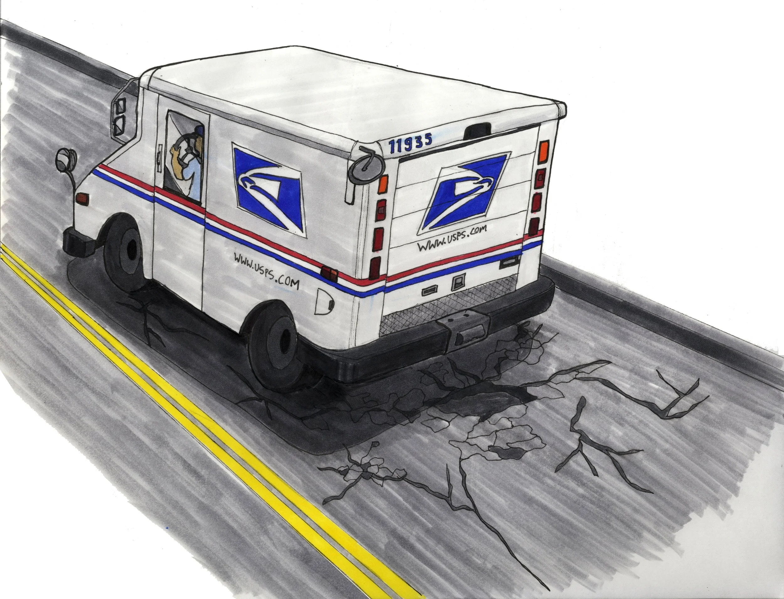
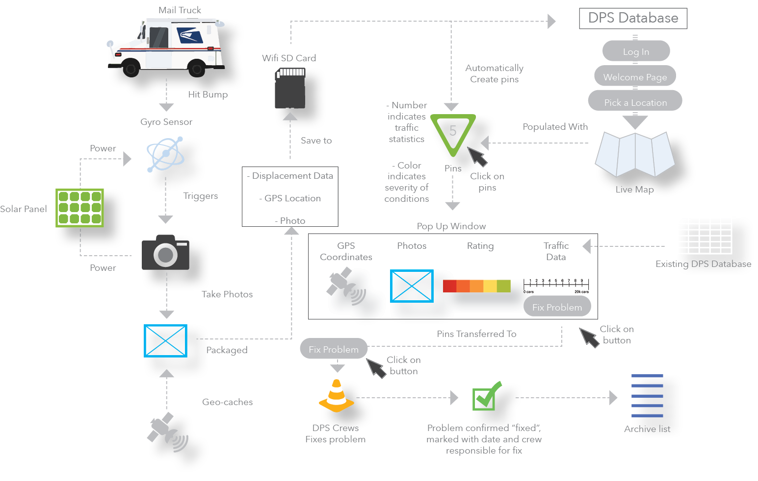
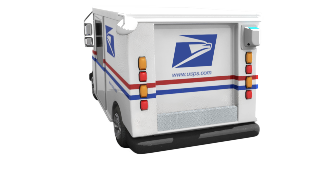
Mail trucks have routes that take them on nearly every road on a regular basis.
GPS systems are standard in mail trucks and can be used to tag photos and data.
This project aims to provide an efficient method for pothole reporting. This project offers an effective solution - an automatic system that can monitor road conditions using postal mail trucks with cameras installed.
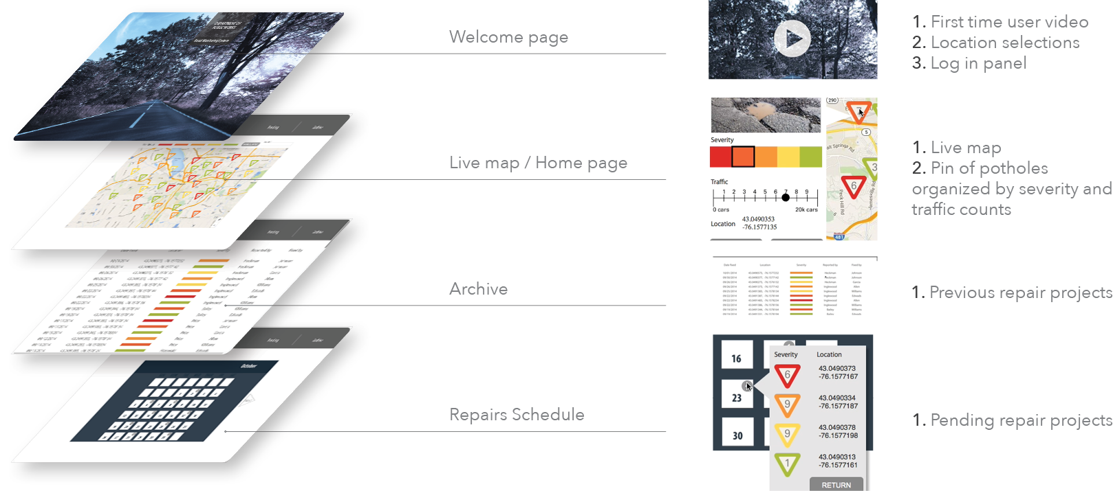
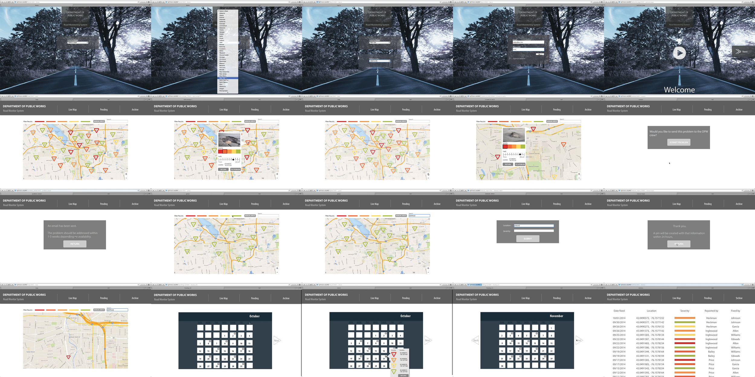
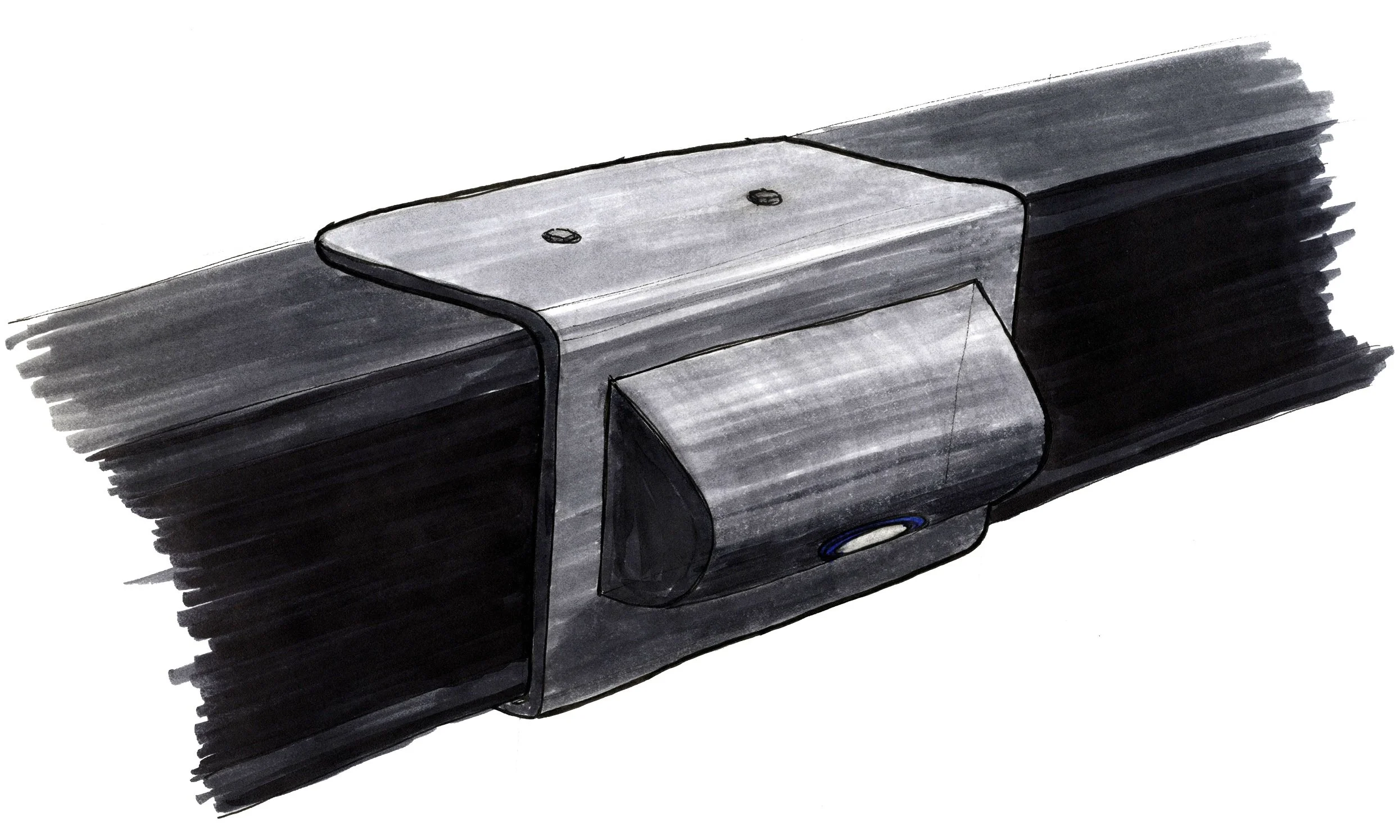
This project is divided into two different parts. The first section includes creating a concept for the physical product, and the second segment involves designing an interactive interface for the database storing information collected by the physical product.
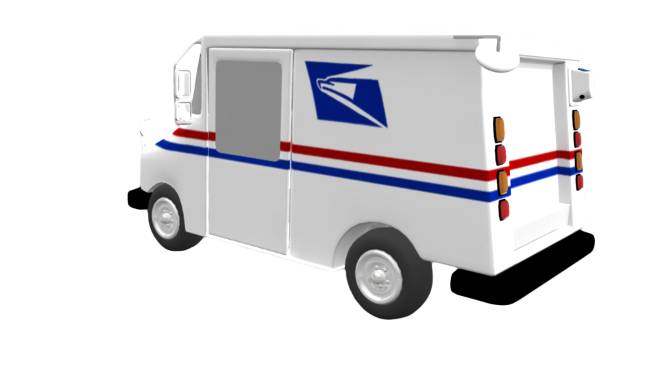
Camera will be wire connected to the GPS navigation system. It allows to pin point the exact location of potholes. Pictures will be instantly attached to the map, making it easier for locate bad road condition.
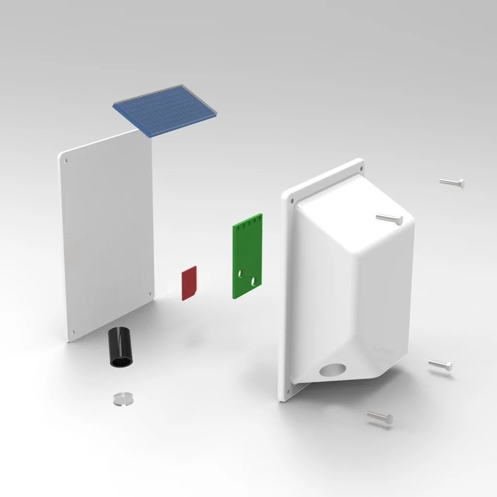

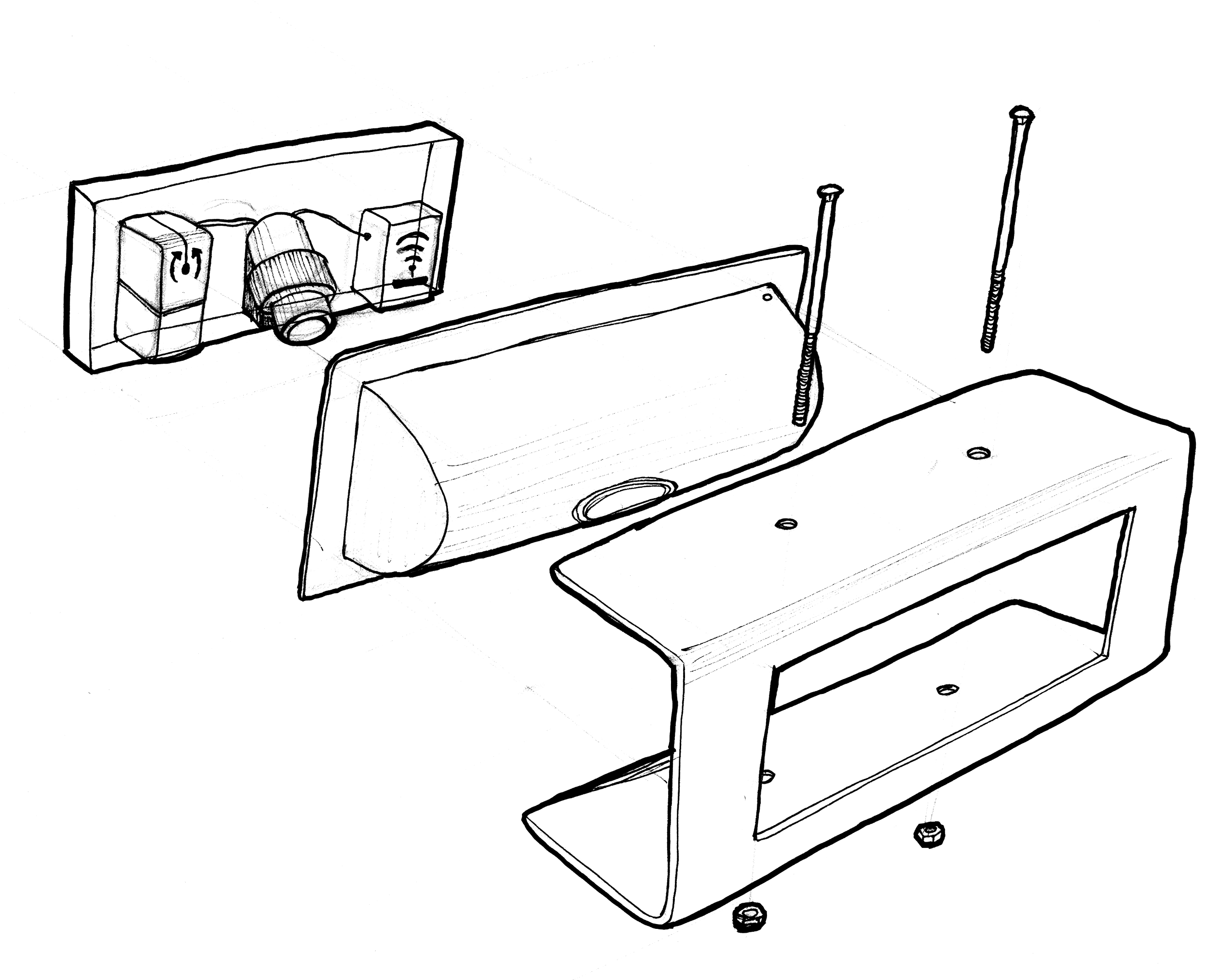
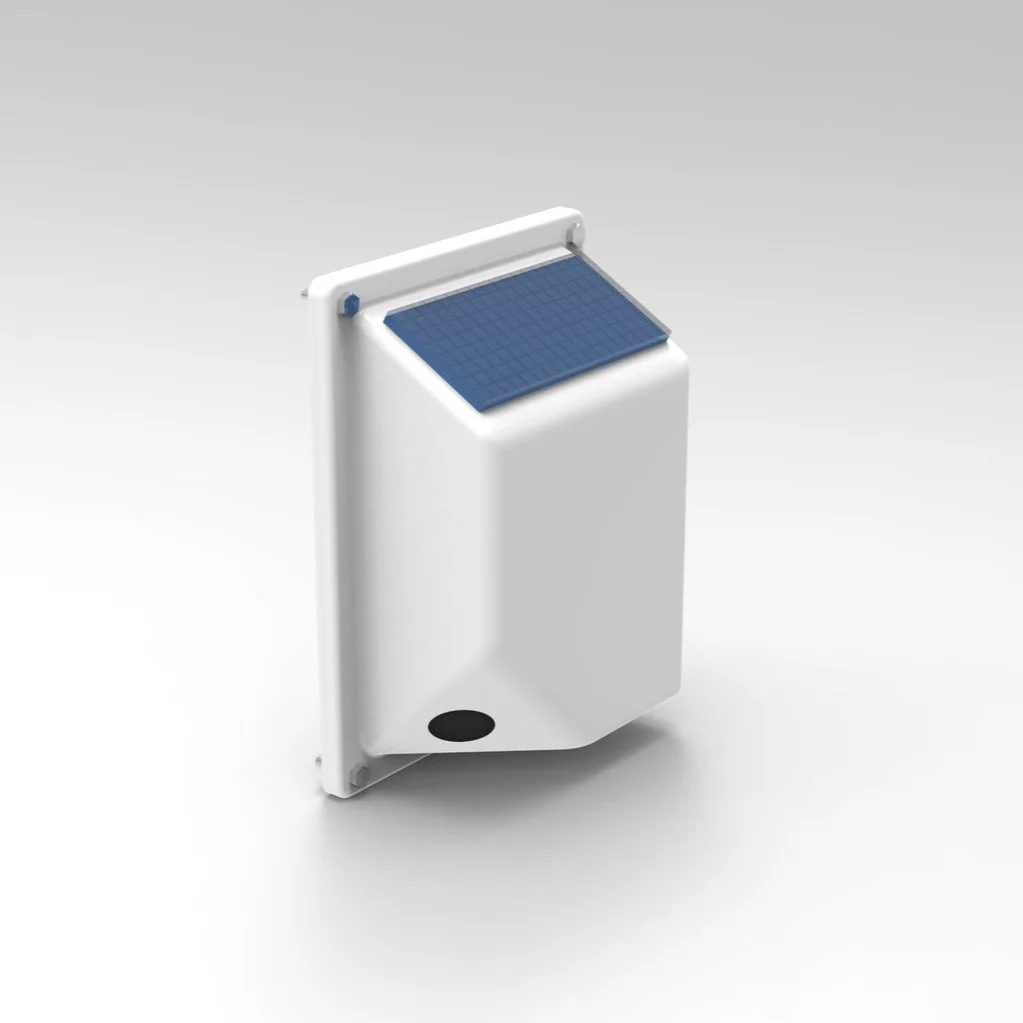
A - Solar Panel
B - Back Case
C - Lens Case
D - Lens Glass
E - WIFI SD Card
F - Gyro Sensor
G - Front Case
H/I/J/K - Screws
Database Design